Case study: Documenting bastides, France’s medieval market towns
Editor’s note: this post was updated to reflect Artstor’s platform changes.

John Reps, Monpazier, 1951 (founded 1284)
In the 13th century, southwestern France gave birth to several hundred new planned towns, partly to replace villages destroyed in the Albigensian Crusades and partly to revivify a stagnating economy and tame areas of wilderness¹. Some were designed as fortress communities, while others were laid out as simple agricultural villages. The great majority, however, had a different function. Known as bastides, they were created as market towns with the aim of concentrating the population in secure places for ease of administration while returning a profit to their sponsors. Their founders were the great feudal lords of the region: kings, dukes, counts, and viscounts.
-
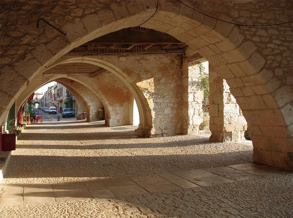
- John Reps, Monpazier: Southeast Arcade Entrance, 1966 (founded 1284)
-
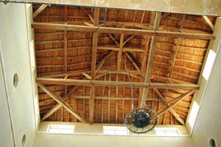
- John Reps, Fleurance: Market Building Ceiling Framing, 2009 (founded 1274)
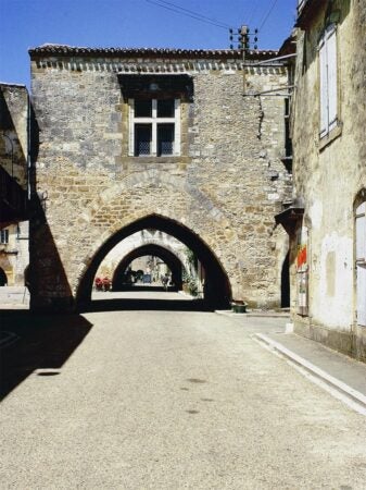
The majority of the bastides were planned with straight streets intersecting at right angles and focused on a square or rectangular marketplace. Complete or partial arcades line the sides of the marketplace at most bastides, and some have a market building at its center. Unlike most other towns of the period, the bastide church did not occupy the most prominent site. Instead, it is usually found off one corner of the square or placed one or two blocks away. Although some bastides have strong walls and gates and are often described as fortified communities, most of these features were later additions constructed during the Hundred Years War or the religious conflicts that followed.
John Reps, Monpazier: From South End West Arcade North to Rue St Jacques, 2009 (founded 1284)
In 1951, Cornell Professor Emeritus John Reps began to explore and document the appearance of these unusual examples of medieval urban design. Over the next 60 years he photographed the towns, now available as Cornell’s Bastides Collection. The collection, cataloged and managed with JSTOR Forum, Artstor’s digital media management service, features more than 2,500 photos hand-picked by Reps himself. Each bastide has been painstakingly plotted on an interactive map by which the viewer can navigate the towns, compare images of the same locations over time, and access a Google Street View for the location depicted in each photo. The site includes specially assembled writings and contextual material. The images are also available to the public for downloading through Artstor’s public collections. View the collection in Artstor here.